Home | Back Rando258002501
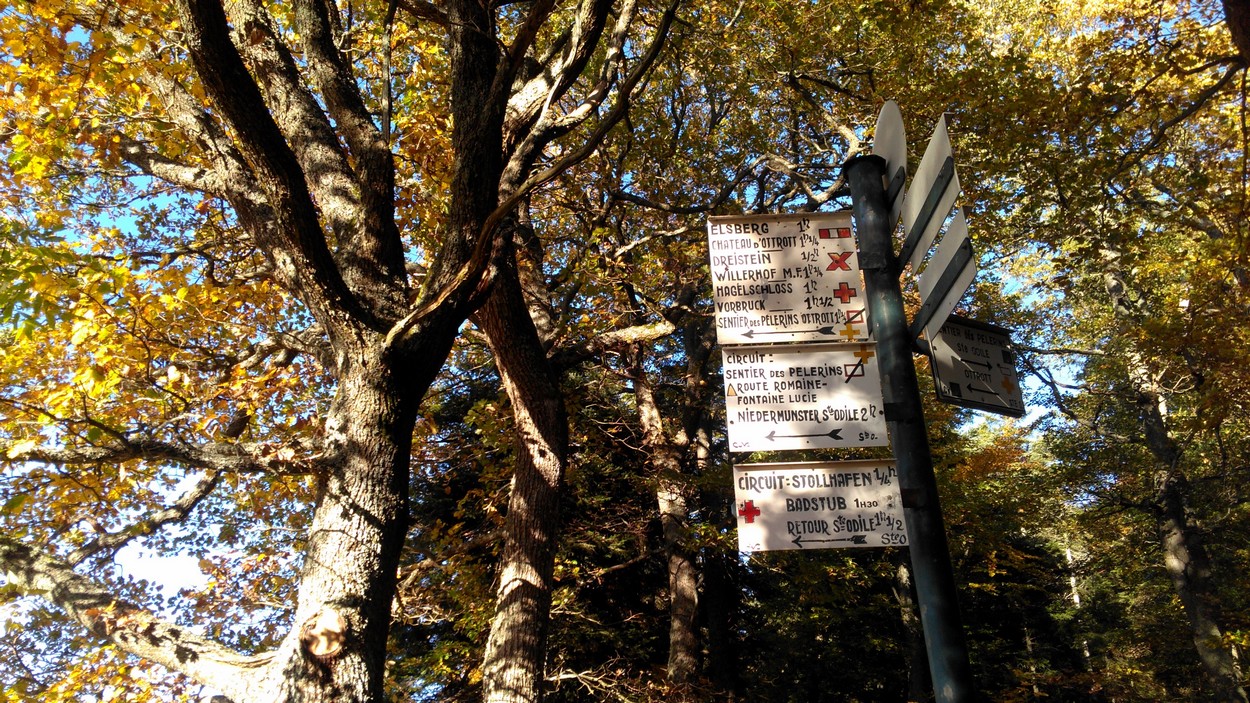
  • Les panneaux du Club Vosgien
    ©D.Wolff
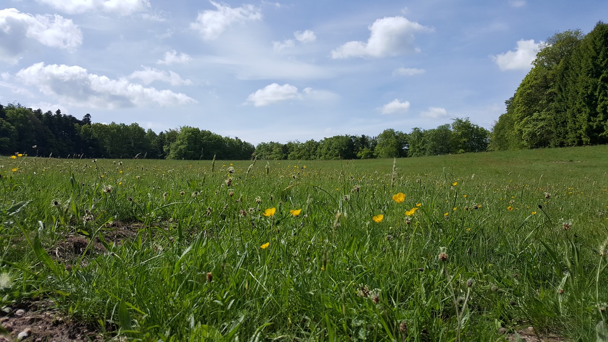
  • La clairière de la Grossmatt
    ©D.Wolff
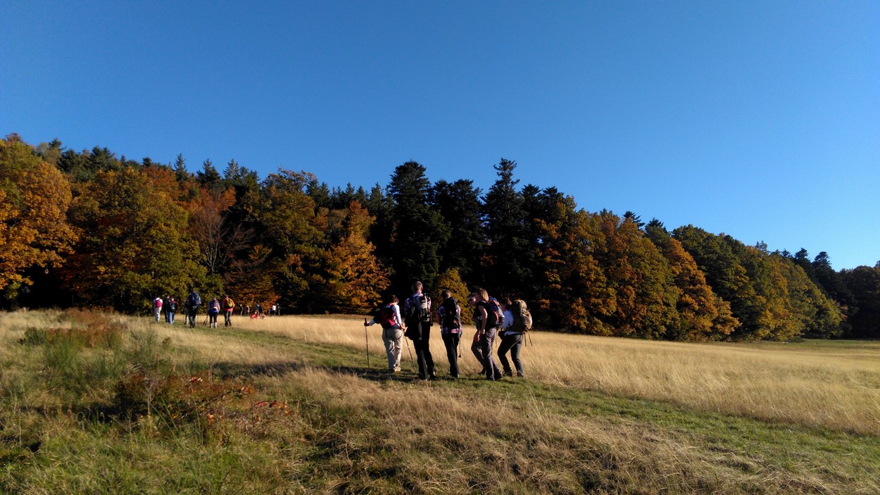
  • Vue automnale sur la Grossmatt
    ©D.Wolff

The Pilgrim's Path

Circuits, sentiers et itinéraires

- 67530 Ottrott

03 88 50 75 38 - contact@mso-tourisme.com
www.mso-tourisme.com

From the reception office of the Tourist Office located in Ottrott-le-Haut, the shell of Saint-Jacques de Compostelle encrusted on the ground, will indicate the path of pilgrims to reach Mont Sainte-Odile, high-place spiritual of Alsace located at 763m of altitude. Doable with children from 8 years old.

- Departure: Tourist Office office
- Route: head towards rue des Châteaux, then rue du Mont Sainte-Odile which leads to the Happiness Trail; the path then overlooks the old quarries of Saint-Nabor before arriving on the 1st vestiges of the Pagan Wall and the clearing of the Grossmatt.
- Duration: 1h to 1h30
- Marking: shell of Saint-Jacques de Compostelle then yellow cross marking.

Equipment required : Walking shoes

o

More informations

Equipment required :

  • Walking shoes

Length of visit/event :

1h30 min

Level of difficulty :

Intermediate

location

Calculate itinerary:

Venue of the event :

Intercommunal Tourist Office of Mont Sainte-Odile

Labels

u

Level of difficulty :

Intermediate

Length of visit/event :

1h30 min

Length of the itinerary :

4
Array
(
    [id] => 258002501
    [nom] => The Pilgrim's Path
    [type] => Array
        (
            [id] => 1900316
            [nom] => Circuits, sentiers et itinéraires
        )

    [entite_gestionnaire] => 258
    [nom_entite_gestionnaire] => Office de tourisme intercommunal du Mont Sainte-Odile
    [coordonnees] => Array
        (
            [code_postal] => 67530
            [libelle_commune] => Ottrott
            [telephone1] => 03 88 50 75 38
            [email1] => contact@mso-tourisme.com
            [url1] => www.mso-tourisme.com
            [pays] => FRANCE
        )

    [insee] => 67368
    [type_georeferencement] => 2
    [libelle_georeferencement] => précis
    [latitude] => 48,4571667568147
    [longitude] => 7,42445269637642
    [commentaire] => From the reception office of the Tourist Office located in Ottrott-le-Haut, the shell of Saint-Jacques de Compostelle encrusted on the ground, will indicate the path of pilgrims to reach Mont Sainte-Odile, high-place spiritual of Alsace located at 763m of altitude. Doable with children from 8 years old. <br><br>
- Departure: Tourist Office office <br>
- Route: head towards rue des Châteaux, then rue du Mont Sainte-Odile which leads to the Happiness Trail; the path then overlooks the old quarries of Saint-Nabor before arriving on the 1st vestiges of the Pagan Wall and the clearing of the Grossmatt.<br>
- Duration: 1h to 1h30<br>
- Marking: shell of Saint-Jacques de Compostelle then yellow cross marking. <br>

    [prestataire] => Array
        (
            [raison_sociale] => OFFICE DE TOURISME INTERCOM DU MONT SAINTE-ODILE
            [civilite] => 
            [nom] => SCHWEBEL
            [prenom] => Christelle
            [fonction] => 
            [coordonnees] => Array
                (
                    [num_voie] => 94
                    [libelle_voie] => rue du Général de Gaulle
                    [distri_speciale] => 
                    [code_postal] => 67560
                    [libelle_commune] => Rosheim
                    [telephone1] => 03 88 50 75 38
                    [telephone2] => 
                    [telephone3] => 
                    [fax] => 
                    [email1] => contact@mso-tourisme.com
                    [email2] => 
                    [url1] => www.mso-tourisme.com
                    [url2] => 
                    [pays] => FRANCE
                )

        )

    [debut_validite] => 24/10/2017
    [fin_validite] => 31/12/2050
    [marquage] => 0
    [datmaj] => 05/12/2024 10:33:53
    [datecreation] => 24/10/2017 15:31:53
    [horaires] => Array
        (
        )

    [produits_associes] => Array
        (
            [0] => Array
                (
                    [id] => 258000592
                    [nom] => Mount Sainte-Odile
                    [id_type] => 1900200
                    [type_couplage] => 10
                )

            [1] => Array
                (
                    [id] => 258000890
                    [nom] => The Marvels Path
                    [id_type] => 1900316
                    [type_couplage] => 10
                )

            [2] => Array
                (
                    [id] => 258000891
                    [nom] => Pagan Wall
                    [id_type] => 1900316
                    [type_couplage] => 10
                )

        )

    [criteres] => Array
        (
            [0] => Array
                (
                    [id] => 900000
                    [nom] => Secteur
                    [type_critere] => -1
                    [type_valeur] => 2
                    [classe] => 0
                    [modalites] => Array
                        (
                            [0] => Array
                                (
                                    [id] => 1903852
                                    [nom] => Région
                                    [ordre] => 0
                                )

                            [1] => Array
                                (
                                    [id] => 1903610
                                    [nom] => Pays Bruche Piémont Mossig
                                    [ordre] => 0
                                )

                            [2] => Array
                                (
                                    [id] => 1901942
                                    [nom] => Pays du sapin de Noël
                                    [ordre] => 0
                                )

                        )

                )

            [1] => Array
                (
                    [id] => 900002
                    [nom] => Tracé KML
                    [type_critere] => 0
                    [type_valeur] => 6
                    [classe] => 2
                    [valeur] => https://apps.tourisme-alsace.info/traces/258002501.kml
                )

            [2] => Array
                (
                    [id] => 900007
                    [nom] => Tracé GPX
                    [type_critere] => 0
                    [type_valeur] => 6
                    [classe] => 2
                    [valeur] => https://apps.tourisme-alsace.info/traces/258002501.gpx
                )

            [3] => Array
                (
                    [id] => 1900219
                    [nom] => Venue of the event
                    [type_critere] => 0
                    [type_valeur] => 2
                    [classe] => 2
                    [valeur] => Intercommunal Tourist Office of Mont Sainte-Odile
                )

            [4] => Array
                (
                    [id] => 1900358
                    [nom] => A transmettre pour Internet
                    [type_critere] => 1
                    [type_valeur] => 2
                    [classe] => 0
                    [modalites] => Array
                        (
                            [0] => Array
                                (
                                    [id] => 1902207
                                    [nom] => Yes
                                    [ordre] => 1
                                )

                        )

                )

            [5] => Array
                (
                    [id] => 1900421
                    [nom] => Photo URL
                    [type_critere] => 0
                    [type_valeur] => 6
                    [classe] => 0
                    [valeur] => https://apps.tourisme-alsace.info/photos/rosheim/photos/258002501_1.jpg
                )

            [6] => Array
                (
                    [id] => 1900461
                    [nom] => Secteur carte
                    [type_critere] => -1
                    [type_valeur] => 2
                    [classe] => 0
                    [modalites] => Array
                        (
                            [0] => Array
                                (
                                    [id] => 1903506
                                    [nom] => Obernai
                                    [ordre] => 0
                                )

                            [1] => Array
                                (
                                    [id] => 1906976
                                    [nom] => Site Barr à proximité
                                    [ordre] => 0
                                )

                            [2] => Array
                                (
                                    [id] => 1908335
                                    [nom] => Massif des Vosges
                                    [ordre] => 0
                                )

                            [3] => Array
                                (
                                    [id] => 1908571
                                    [nom] => Route des vins (site Alsace)
                                    [ordre] => 0
                                )

                            [4] => Array
                                (
                                    [id] => 1909124
                                    [nom] => Massif Vosges - Vosges centrales
                                    [ordre] => 0
                                )

                            [5] => Array
                                (
                                    [id] => 1909236
                                    [nom] => Oenotourisme - Coeur d'Alsace
                                    [ordre] => 0
                                )

                            [6] => Array
                                (
                                    [id] => 1911639
                                    [nom] => Alsace (site Alsace)
                                    [ordre] => 0
                                )

                            [7] => Array
                                (
                                    [id] => 1909895
                                    [nom] => Vélo Colmar et centre Alsaceet nord
                                    [ordre] => 0
                                )

                        )

                )

            [7] => Array
                (
                    [id] => 1900463
                    [nom] => Villages label
                    [type_critere] => -1
                    [type_valeur] => 2
                    [classe] => 1
                    [modalites] => Array
                        (
                            [0] => Array
                                (
                                    [id] => 1903444
                                    [nom] => Approved "green stop" villages
                                    [ordre] => 60
                                )

                        )

                )

            [8] => Array
                (
                    [id] => 1900480
                    [nom] => Photo caption
                    [type_critere] => 0
                    [type_valeur] => 2
                    [classe] => 0
                    [valeur] => ©D.Wolff
                )

            [9] => Array
                (
                    [id] => 1900482
                    [nom] => Commentaire court EN
                    [type_critere] => 0
                    [type_valeur] => 2
                    [classe] => 4
                    [valeur] => A beautiful hike in the woods to reach Mont Sainte-Odile, following in the footsteps of pilgrims of yesteryear and today.
                )

            [10] => Array
                (
                    [id] => 1900487
                    [nom] => Length of visit/event
                    [type_critere] => 1
                    [type_valeur] => 2
                    [classe] => 4
                    [modalites] => Array
                        (
                            [0] => Array
                                (
                                    [id] => 1903645
                                    [nom] => 1h30 min
                                    [ordre] => 16
                                )

                        )

                )

            [11] => Array
                (
                    [id] => 1900564
                    [nom] => Level of difficulty
                    [type_critere] => 1
                    [type_valeur] => 2
                    [classe] => 4
                    [modalites] => Array
                        (
                            [0] => Array
                                (
                                    [id] => 1904403
                                    [nom] => Intermediate
                                    [ordre] => 2
                                )

                        )

                )

            [12] => Array
                (
                    [id] => 1900603
                    [nom] => Photo URL2
                    [type_critere] => 0
                    [type_valeur] => 6
                    [classe] => 0
                    [valeur] => https://apps.tourisme-alsace.info/photos/rosheim/photos/258002501_5.jpg
                )

            [13] => Array
                (
                    [id] => 1900621
                    [nom] => Equipment required
                    [type_critere] => -1
                    [type_valeur] => 2
                    [classe] => 4
                    [modalites] => Array
                        (
                            [0] => Array
                                (
                                    [id] => 1905151
                                    [nom] => Walking shoes
                                    [ordre] => 220
                                )

                        )

                )

            [14] => Array
                (
                    [id] => 1900661
                    [nom] => Photo légende 2
                    [type_critere] => 0
                    [type_valeur] => 2
                    [classe] => 0
                    [valeur] => ©D.Wolff
                )

            [15] => Array
                (
                    [id] => 1900714
                    [nom] => Interest
                    [type_critere] => 1
                    [type_valeur] => 2
                    [classe] => 0
                    [modalites] => Array
                        (
                            [0] => Array
                                (
                                    [id] => 1905854
                                    [nom] => Interest on a regional scale (between 8 and 35 km)
                                    [ordre] => 10
                                )

                        )

                )

            [16] => Array
                (
                    [id] => 1900739
                    [nom] => Brochures 2006
                    [type_critere] => -1
                    [type_valeur] => 2
                    [classe] => 0
                    [modalites] => Array
                        (
                            [0] => Array
                                (
                                    [id] => 1912202
                                    [nom] => Fiche pour Cirkwi
                                    [ordre] => 0
                                )

                            [1] => Array
                                (
                                    [id] => 1911829
                                    [nom] => Site web ADOTGE
                                    [ordre] => 850
                                )

                        )

                )

            [17] => Array
                (
                    [id] => 1900751
                    [nom] => Photo URL3
                    [type_critere] => 0
                    [type_valeur] => 6
                    [classe] => 0
                    [valeur] => https://apps.tourisme-alsace.info/photos/rosheim/photos/258002501_6.jpg
                )

            [18] => Array
                (
                    [id] => 1900752
                    [nom] => Photo légende 3
                    [type_critere] => 0
                    [type_valeur] => 2
                    [classe] => 0
                    [valeur] => ©D.Wolff
                )

            [19] => Array
                (
                    [id] => 1900886
                    [nom] => Secteur carte Obernai
                    [type_critere] => 1
                    [type_valeur] => 2
                    [classe] => 0
                    [modalites] => Array
                        (
                            [0] => Array
                                (
                                    [id] => 1907238
                                    [nom] => D3
                                    [ordre] => 0
                                )

                        )

                )

            [20] => Array
                (
                    [id] => 1900916
                    [nom] => Length of the itinerary
                    [type_critere] => 0
                    [type_valeur] => 1
                    [classe] => 4
                    [valeur] => 4
                )

            [21] => Array
                (
                    [id] => 1900921
                    [nom] => Type of marking
                    [type_critere] => -1
                    [type_valeur] => 2
                    [classe] => 4
                    [modalites] => Array
                        (
                            [0] => Array
                                (
                                    [id] => 1907407
                                    [nom] => Club vosgien
                                    [ordre] => 10
                                )

                        )

                )

            [22] => Array
                (
                    [id] => 1901199
                    [nom] => Type of path, circuit
                    [type_critere] => -1
                    [type_valeur] => 2
                    [classe] => 4
                    [modalites] => Array
                        (
                            [0] => Array
                                (
                                    [id] => 1909135
                                    [nom] => hiking path
                                    [ordre] => 140
                                )

                        )

                )

            [23] => Array
                (
                    [id] => 1901313
                    [nom] => Address - location information of car park closest to departure point
                    [type_critere] => 0
                    [type_valeur] => 2
                    [classe] => 1
                    [valeur] => Town Hall car park
                )

            [24] => Array
                (
                    [id] => 1901314
                    [nom] => Commentaire traduit en
                    [type_critere] => -1
                    [type_valeur] => 2
                    [classe] => 0
                    [modalites] => Array
                        (
                            [0] => Array
                                (
                                    [id] => 1909728
                                    [nom] => DE
                                    [ordre] => 0
                                )

                            [1] => Array
                                (
                                    [id] => 1909727
                                    [nom] => FR
                                    [ordre] => 0
                                )

                            [2] => Array
                                (
                                    [id] => 1909729
                                    [nom] => EN
                                    [ordre] => 0
                                )

                        )

                )

            [25] => Array
                (
                    [id] => 1901318
                    [nom] => Markings to follow
                    [type_critere] => 0
                    [type_valeur] => 2
                    [classe] => 32
                    [valeur] => Yellow cross
                )

            [26] => Array
                (
                    [id] => 1901319
                    [nom] => Type of hiking path
                    [type_critere] => -1
                    [type_valeur] => 2
                    [classe] => 32
                    [modalites] => Array
                        (
                            [0] => Array
                                (
                                    [id] => 1909742
                                    [nom] => path
                                    [ordre] => 0
                                )

                        )

                )

            [27] => Array
                (
                    [id] => 1901413
                    [nom] => Tarif synthétique (avizi)
                    [type_critere] => 0
                    [type_valeur] => 1
                    [classe] => 32
                    [valeur] => -1
                )

            [28] => Array
                (
                    [id] => 1901440
                    [nom] => GRC accroche
                    [type_critere] => 0
                    [type_valeur] => 2
                    [classe] => 4
                    [valeur] => A beautiful hike in the woods to reach Mont Sainte-Odile, following in the footsteps of pilgrims of yesteryear and today.
                )

            [29] => Array
                (
                    [id] => 1901460
                    [nom] => URL photo GRC 2-3
                    [type_critere] => 0
                    [type_valeur] => 6
                    [classe] => 1
                    [valeur] => apps.tourisme-alsace.info/photos/rosheim/photos/258002501_1_258x100.jpg
                )

            [30] => Array
                (
                    [id] => 1901463
                    [nom] => Légende photo 1
                    [type_critere] => 0
                    [type_valeur] => 2
                    [classe] => 0
                    [valeur] => Les panneaux du Club Vosgien
                )

            [31] => Array
                (
                    [id] => 1901464
                    [nom] => Légende photo 2
                    [type_critere] => 0
                    [type_valeur] => 2
                    [classe] => 0
                    [valeur] => La clairière de la Grossmatt
                )

            [32] => Array
                (
                    [id] => 1901465
                    [nom] => Légende photo 3
                    [type_critere] => 0
                    [type_valeur] => 2
                    [classe] => 0
                    [valeur] => Vue automnale sur la Grossmatt
                )

            [33] => Array
                (
                    [id] => 1901479
                    [nom] => PDF GRC
                    [type_critere] => -1
                    [type_valeur] => 2
                    [classe] => 0
                    [modalites] => Array
                        (
                            [0] => Array
                                (
                                    [id] => 1911668
                                    [nom] => J7
                                    [ordre] => 400
                                )

                        )

                )

            [34] => Array
                (
                    [id] => 1901495
                    [nom] => Liesel - inspiration
                    [type_critere] => 1
                    [type_valeur] => 2
                    [classe] => 0
                    [modalites] => Array
                        (
                            [0] => Array
                                (
                                    [id] => 1911411
                                    [nom] => Bouger, se défouler
                                    [ordre] => 50
                                )

                        )

                )

            [35] => Array
                (
                    [id] => 1901499
                    [nom] => La photo est disponible en OpenData (Datatourisme)
                    [type_critere] => 1
                    [type_valeur] => 2
                    [classe] => 0
                    [modalites] => Array
                        (
                            [0] => Array
                                (
                                    [id] => 1911420
                                    [nom] => Oui
                                    [ordre] => 10
                                )

                        )

                )

            [36] => Array
                (
                    [id] => 1901505
                    [nom] => Type de circuit, itinéraire
                    [type_critere] => 1
                    [type_valeur] => 2
                    [classe] => 4
                    [modalites] => Array
                        (
                            [0] => Array
                                (
                                    [id] => 1911537
                                    [nom] => Pedestrian
                                    [ordre] => 10
                                )

                        )

                )

            [37] => Array
                (
                    [id] => 1901509
                    [nom] => URL site Liesel
                    [type_critere] => 0
                    [type_valeur] => 6
                    [classe] => 0
                    [valeur] => https://en.liesel.alsace/article/sentier-des-pelerins-258002501
                )

            [38] => Array
                (
                    [id] => 1901511
                    [nom] => Thèmes du circuit
                    [type_critere] => -1
                    [type_valeur] => 2
                    [classe] => 4
                    [modalites] => Array
                        (
                            [0] => Array
                                (
                                    [id] => 1911612
                                    [nom] => Forest
                                    [ordre] => 70
                                )

                        )

                )

            [39] => Array
                (
                    [id] => 1901517
                    [nom] => Url photo Opendata
                    [type_critere] => 0
                    [type_valeur] => 6
                    [classe] => 0
                    [valeur] => https://opendata.tourisme-alsace.info/photos/rosheim/photos/258002501_1_800x600.jpg
                )

            [40] => Array
                (
                    [id] => 1901518
                    [nom] => Légende photo open data
                    [type_critere] => 0
                    [type_valeur] => 2
                    [classe] => 0
                    [valeur] => Les panneaux du Club Vosgien
                )

            [41] => Array
                (
                    [id] => 1901519
                    [nom] => Cpyright photo Opendata
                    [type_critere] => 0
                    [type_valeur] => 2
                    [classe] => 0
                    [valeur] => ©D.Wolff
                )

            [42] => Array
                (
                    [id] => 1901523
                    [nom] => Nom de la gare la plus proche
                    [type_critere] => 0
                    [type_valeur] => 2
                    [classe] => 2
                    [valeur] => Obernai
                )

            [43] => Array
                (
                    [id] => 258000003
                    [nom] => Odile site Internet
                    [type_critere] => 1
                    [type_valeur] => 2
                    [classe] => 32
                    [modalites] => Array
                        (
                            [0] => Array
                                (
                                    [id] => 258000005
                                    [nom] => yes
                                    [ordre] => 
                                )

                        )

                )

            [44] => Array
                (
                    [id] => 258000021
                    [nom] => OTI : participez
                    [type_critere] => -1
                    [type_valeur] => 2
                    [classe] => 32
                    [modalites] => Array
                        (
                            [0] => Array
                                (
                                    [id] => 258000087
                                    [nom] => Sentiers, balades, randos
                                    [ordre] => 0
                                )

                        )

                )

            [45] => Array
                (
                    [id] => 258000051
                    [nom] => OTI Explorez
                    [type_critere] => -1
                    [type_valeur] => 2
                    [classe] => 32
                    [modalites] => Array
                        (
                            [0] => Array
                                (
                                    [id] => 258000133
                                    [nom] => Rando, vélo
                                    [ordre] => 4
                                )

                        )

                )

            [46] => Array
                (
                    [id] => 258000053
                    [nom] => OTI Agenda
                    [type_critere] => -1
                    [type_valeur] => 2
                    [classe] => 32
                    [modalites] => Array
                        (
                            [0] => Array
                                (
                                    [id] => 258000138
                                    [nom] => Randonnée/sorties natures
                                    [ordre] => 10
                                )

                        )

                )

            [47] => Array
                (
                    [id] => 258000558
                    [nom] => Pour tri par commune
                    [type_critere] => 1
                    [type_valeur] => 2
                    [classe] => 32
                    [modalites] => Array
                        (
                            [0] => Array
                                (
                                    [id] => 258000483
                                    [nom] => Ottrott
                                    [ordre] => 60
                                )

                        )

                )

        )

    [disponibilites_synthetiques] => Array
        (
        )

    [disponibilites_detail] => Array
        (
        )

)
Aller en haut
Aller en dessous