Grendelbruch
District sheet, Locality/site sheet
03 88 97 40 79 - mairie.grendelbruch@wanadoo.fr
www.grendelbruch.fr
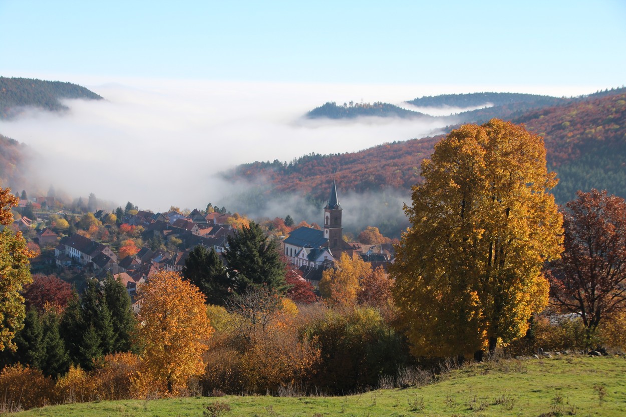
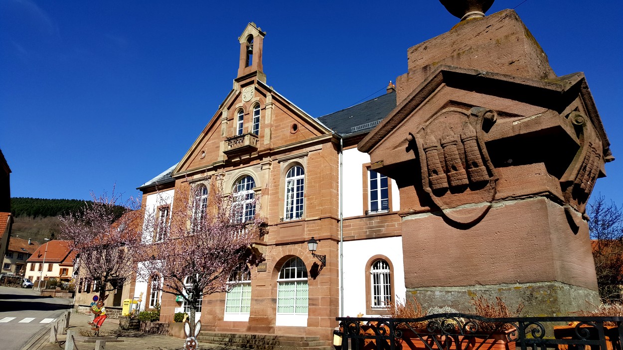
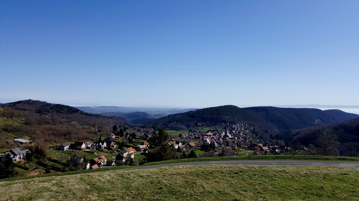
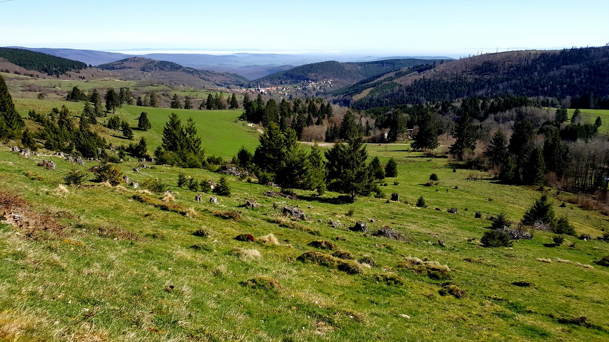
Grendelbruch, a low-mountain forest municipality of approximately 1,200 inhabitants, nestles in a green valley surrounded by forest. There is a height difference of 500m between the centre of the village, located at 550 m, and its highest point, Hohbühl, at 1,031m. Forestry was long the source not only of the municipality’s wealth, but also of a logging culture honoured to this day by the Métiers du Bois (timber trades) parade in July, the Fête des Bûcherons (the “Lumberjacks’ Festival”) in August and the Christmas market in Pays des Bûcherons (Lumberjack Country). The site also lends itself very well to numerous activities. During the summer, the high pastures of the Hohbühl welcome kite fliers and paragliders while hikers, pony trekkers and mountain bikers enjoy their activities making the most of the shade offered by the trees. Fly fishing enthusiasts can exercise their art in the Magel, where trouts are still plentiful. The exceptional Hohbühl site, which, on a clear day, offers a view over the whole Alsace plain right up to the first foothills of the Black Forest, becomes a ski area in winter, with cross-country ski trails which allow you to visit the Champ du Feu. The beautiful snow-covered slopes are perfect for snowshoe hiking and sledging, a fun activity for children.
Altitude (m) :
500location
Calculate itinerary:
This might interest you too
The military cemetery and the Route of the “Souvenir Français”
Grendelbruch+
The signal of Hohbühl
Grendelbruch+
Saint Pancrace and Saint Cyriaque Chapel
Grendelbruch+
Array
(
[id] => 258000737
[nom] => Grendelbruch
[type] => Array
(
[id] => 1900239
[nom] => District sheet, Locality/site sheet
)
[entite_gestionnaire] => 258
[nom_entite_gestionnaire] => Office de tourisme intercommunal du Mont Sainte-Odile
[coordonnees] => Array
(
[code_postal] => 67190
[libelle_commune] => Grendelbruch
[telephone1] => 03 88 97 40 79
[email1] => mairie.grendelbruch@wanadoo.fr
[url1] => www.grendelbruch.fr
[pays] => FRANCE
)
[insee] => 67167
[type_georeferencement] => 2
[libelle_georeferencement] => précis
[latitude] => 48,4922789977555
[longitude] => 7,32306361198425
[commentaire] => Grendelbruch, a low-mountain forest municipality of approximately 1,200 inhabitants, nestles in a green valley surrounded by forest. There is a height difference of 500m between the centre of the village, located at 550 m, and its highest point, Hohbühl, at 1,031m. Forestry was long the source not only of the municipality’s wealth, but also of a logging culture honoured to this day by the Métiers du Bois (timber trades) parade in July, the Fête des Bûcherons (the “Lumberjacks’ Festival”) in August and the Christmas market in Pays des Bûcherons (Lumberjack Country). The site also lends itself very well to numerous activities. During the summer, the high pastures of the Hohbühl welcome kite fliers and paragliders while hikers, pony trekkers and mountain bikers enjoy their activities making the most of the shade offered by the trees. Fly fishing enthusiasts can exercise their art in the Magel, where trouts are still plentiful. The exceptional Hohbühl site, which, on a clear day, offers a view over the whole Alsace plain right up to the first foothills of the Black Forest, becomes a ski area in winter, with cross-country ski trails which allow you to visit the Champ du Feu. The beautiful snow-covered slopes are perfect for snowshoe hiking and sledging, a fun activity for children.
[prestataire] => Array
(
[raison_sociale] => Le sentier des crèches
[civilite] =>
[nom] =>
[prenom] =>
[fonction] =>
[coordonnees] => Array
(
[num_voie] =>
[libelle_voie] =>
[distri_speciale] =>
[code_postal] => 67190
[libelle_commune] => Grendelbruch
[telephone1] => 03 88 97 40 79
[telephone2] =>
[telephone3] =>
[fax] =>
[email1] =>
[email2] =>
[url1] =>
[url2] =>
[pays] => FRANCE
)
)
[debut_validite] => 01/01/1900
[fin_validite] => 31/12/2050
[marquage] => 0
[datmaj] => 24/09/2025 13:58:52
[datecreation] => 26/04/2012 14:39:51
[horaires] => Array
(
)
[produits_associes] => Array
(
[0] => Array
(
[id] => 258000855
[nom] => The military cemetery and the Route of the “Souvenir Français”
[id_type] => 1900200
[type_couplage] => 10
)
[1] => Array
(
[id] => 258002515
[nom] => The signal of Hohbühl
[id_type] => 1900200
[type_couplage] => 10
)
[2] => Array
(
[id] => 258002708
[nom] => Saint Pancrace and Saint Cyriaque Chapel
[id_type] => 1900200
[type_couplage] => 10
)
)
[criteres] => Array
(
[0] => Array
(
[id] => 900000
[nom] => Secteur
[type_critere] => -1
[type_valeur] => 2
[classe] => 0
[modalites] => Array
(
[0] => Array
(
[id] => 1903852
[nom] => Région
[ordre] => 0
)
)
)
[1] => Array
(
[id] => 1900049
[nom] => Altitude (m)
[type_critere] => 0
[type_valeur] => 1
[classe] => 2
[valeur] => 500
)
[2] => Array
(
[id] => 1900179
[nom] => Classification Flowered Villages
[type_critere] => 1
[type_valeur] => 2
[classe] => 1
[modalites] => Array
(
[0] => Array
(
[id] => 1900892
[nom] => 1 flower
[ordre] => 1
)
)
)
[3] => Array
(
[id] => 1900358
[nom] => A transmettre pour Internet
[type_critere] => 1
[type_valeur] => 2
[classe] => 0
[modalites] => Array
(
[0] => Array
(
[id] => 1902207
[nom] => Yes
[ordre] => 1
)
)
)
[4] => Array
(
[id] => 1900421
[nom] => Photo URL
[type_critere] => 0
[type_valeur] => 6
[classe] => 0
[valeur] => https://apps.tourisme-alsace.info/photos/rosheim/photos/258000737_1.jpg
)
[5] => Array
(
[id] => 1900461
[nom] => Secteur carte
[type_critere] => -1
[type_valeur] => 2
[classe] => 0
[modalites] => Array
(
[0] => Array
(
[id] => 1903506
[nom] => Obernai
[ordre] => 0
)
[1] => Array
(
[id] => 1908335
[nom] => Massif des Vosges
[ordre] => 0
)
[2] => Array
(
[id] => 1908572
[nom] => Massif des Vosges (site Alsace)
[ordre] => 0
)
[3] => Array
(
[id] => 1908574
[nom] => Vosges centrales (site Alsace)
[ordre] => 0
)
[4] => Array
(
[id] => 1909124
[nom] => Massif Vosges - Vosges centrales
[ordre] => 0
)
[5] => Array
(
[id] => 1911639
[nom] => Alsace (site Alsace)
[ordre] => 0
)
[6] => Array
(
[id] => 1909895
[nom] => Vélo Colmar et centre Alsaceet nord
[ordre] => 0
)
)
)
[6] => Array
(
[id] => 1900480
[nom] => Photo caption
[type_critere] => 0
[type_valeur] => 2
[classe] => 0
[valeur] => Vue panoramique - ©R.Della Vecchia
)
[7] => Array
(
[id] => 1900603
[nom] => Photo URL2
[type_critere] => 0
[type_valeur] => 6
[classe] => 0
[valeur] => https://apps.tourisme-alsace.info/photos/rosheim/photos/258000737_4.jpg
)
[8] => Array
(
[id] => 1900661
[nom] => Photo légende 2
[type_critere] => 0
[type_valeur] => 2
[classe] => 0
[valeur] => La fontaine et l'hôtel de ville - ©D.Wolff
)
[9] => Array
(
[id] => 1900751
[nom] => Photo URL3
[type_critere] => 0
[type_valeur] => 6
[classe] => 0
[valeur] => https://apps.tourisme-alsace.info/photos/rosheim/photos/258000737_5.jpg
)
[10] => Array
(
[id] => 1900752
[nom] => Photo légende 3
[type_critere] => 0
[type_valeur] => 2
[classe] => 0
[valeur] => Vue depuis la nécropole nationale - ©D.Wolff
)
[11] => Array
(
[id] => 1900781
[nom] => Photo URL4
[type_critere] => 0
[type_valeur] => 6
[classe] => 0
[valeur] => https://apps.tourisme-alsace.info/photos/rosheim/photos/258000737_6.jpg
)
[12] => Array
(
[id] => 1900783
[nom] => Photo légende 4
[type_critere] => 0
[type_valeur] => 2
[classe] => 0
[valeur] => Vue panoramique depuis les hauteurs du village - ©D.Wolff
)
[13] => Array
(
[id] => 1901314
[nom] => Commentaire traduit en
[type_critere] => -1
[type_valeur] => 2
[classe] => 0
[modalites] => Array
(
[0] => Array
(
[id] => 1909729
[nom] => EN
[ordre] => 0
)
[1] => Array
(
[id] => 1909727
[nom] => FR
[ordre] => 0
)
[2] => Array
(
[id] => 1909728
[nom] => DE
[ordre] => 0
)
)
)
[14] => Array
(
[id] => 1901413
[nom] => Tarif synthétique (avizi)
[type_critere] => 0
[type_valeur] => 1
[classe] => 32
[valeur] => -1
)
[15] => Array
(
[id] => 1901509
[nom] => URL site Liesel
[type_critere] => 0
[type_valeur] => 6
[classe] => 0
[valeur] => https://en.liesel.alsace/article/grendelbruch-258000737
)
[16] => Array
(
[id] => 220000052
[nom] => Site_web_2025
[type_critere] => -1
[type_valeur] => 2
[classe] => 32
[modalites] => Array
(
[0] => Array
(
[id] => 220005732
[nom] => découvrez_ste_odile_villages
[ordre] => 78
)
)
)
[17] => Array
(
[id] => 258000003
[nom] => Odile site Internet
[type_critere] => 1
[type_valeur] => 2
[classe] => 32
[modalites] => Array
(
[0] => Array
(
[id] => 258000005
[nom] => yes
[ordre] =>
)
)
)
[18] => Array
(
[id] => 258000020
[nom] => OTI : découvrez
[type_critere] => -1
[type_valeur] => 2
[classe] => 32
[modalites] => Array
(
[0] => Array
(
[id] => 258000083
[nom] => Villages
[ordre] => 10
)
)
)
[19] => Array
(
[id] => 258000558
[nom] => Pour tri par commune
[type_critere] => 1
[type_valeur] => 2
[classe] => 32
[modalites] => Array
(
[0] => Array
(
[id] => 258000481
[nom] => Grendelbruch
[ordre] => 30
)
)
)
[20] => Array
(
[id] => 401000001
[nom] => Nom de la route
[type_critere] => 2
[type_valeur] => 1
[classe] => 32
[modalites] => Array
(
[0] => Array
(
[id] => 401000022
[nom] => route des Vosges centrales
[ordre] =>
[valeur] => 220
)
)
)
[21] => Array
(
[id] => 401000005
[nom] => Fiche commune
[type_critere] => -1
[type_valeur] => 2
[classe] => 32
[modalites] => Array
(
[0] => Array
(
[id] => 401000038
[nom] => POI
[ordre] =>
)
[1] => Array
(
[id] => 401000037
[nom] => yes
[ordre] =>
)
)
)
)
[disponibilites_synthetiques] => Array
(
)
[disponibilites_detail] => Array
(
)
)


