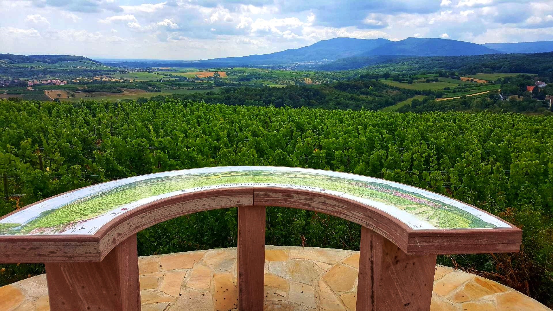
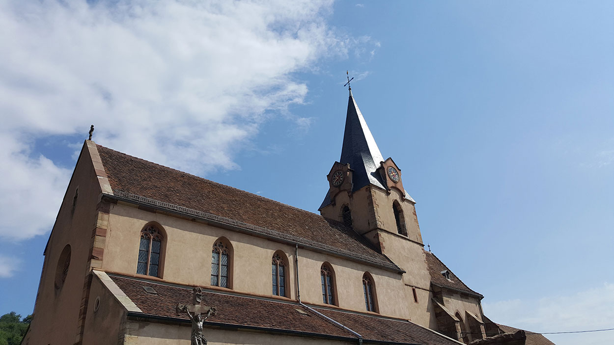
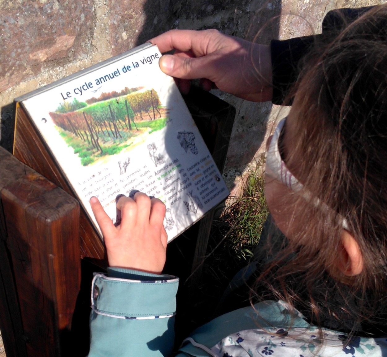
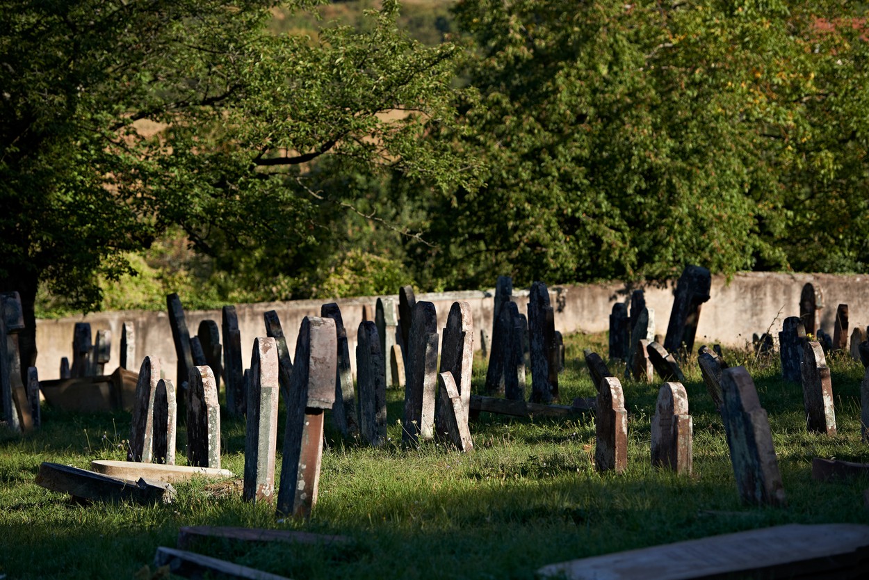
A charming wine-growing village, Rosenwiller is located in the hills above Rosheim, surrounded by hills rich with especially diverse wildlife and plants. At the edge of the woods, the Jewish Cemetery, one of the oldest Jewish cemeteries in Alsace, contains over 6,000 tombs featuring highly original sun patterns on the gravestones. A stroll through the vineyards will give you the chance to admire the panoramic views of the plain, before going to taste the various grape types of Alsace wine, which have been grown here since the 6th century.
o
location
Calculate itinerary:
This might interest you too
Notre-Dame de l’Assomption Church
Rosenwiller+
"From Hills to Vineyards” ("De collines en vignoble") - Discovery Path
Rosenwiller+
The Jewish cemetery
Rosenwiller+
Orientation table
Rosenwiller+
Array
(
[id] => 258000744
[nom] => Rosenwiller
[type] => Array
(
[id] => 1900239
[nom] => District sheet, Locality/site sheet
)
[entite_gestionnaire] => 258
[nom_entite_gestionnaire] => Office de tourisme intercommunal du Mont Sainte-Odile
[coordonnees] => Array
(
[code_postal] => 67560
[libelle_commune] => Rosenwiller
[telephone1] => 03 88 50 41 66
[email1] => mairie.rosenwiller@wanadoo.fr
[pays] => FRANCE
)
[insee] => 67410
[type_georeferencement] => 2
[libelle_georeferencement] => précis
[latitude] => 48,5057377551172
[longitude] => 7,44030565023422
[commentaire] => A charming wine-growing village, Rosenwiller is located in the hills above Rosheim, surrounded by hills rich with especially diverse wildlife and plants. At the edge of the woods, the Jewish Cemetery, one of the oldest Jewish cemeteries in Alsace, contains over 6,000 tombs featuring highly original sun patterns on the gravestones. A stroll through the vineyards will give you the chance to admire the panoramic views of the plain, before going to taste the various grape types of Alsace wine, which have been grown here since the 6th century.
[prestataire] => Array
(
[raison_sociale] => MAIRIE DE ROSENWILLER
[civilite] =>
[nom] =>
[prenom] =>
[fonction] =>
[coordonnees] => Array
(
[num_voie] => 2
[libelle_voie] => Place de l'Église
[distri_speciale] =>
[code_postal] => 67560
[libelle_commune] => Rosenwiller
[telephone1] => 03 88 50 41 66
[telephone2] =>
[telephone3] =>
[fax] =>
[email1] => secretariat@rosenwiller.com
[email2] =>
[url1] =>
[url2] =>
[pays] => FRANCE
)
)
[debut_validite] => 01/01/1900
[fin_validite] => 31/12/2050
[marquage] => 0
[datmaj] => 27/01/2026 11:32:29
[datecreation] => 04/11/2011 11:15:59
[horaires] => Array
(
)
[produits_associes] => Array
(
[0] => Array
(
[id] => 258000764
[nom] => Notre-Dame de l’Assomption Church
[id_type] => 1900200
[type_couplage] => 10
)
[1] => Array
(
[id] => 258000886
[nom] => "From Hills to Vineyards” ("De collines en vignoble") - Discovery Path
[id_type] => 1900316
[type_couplage] => 10
)
[2] => Array
(
[id] => 258001967
[nom] => The Jewish cemetery
[id_type] => 1900200
[type_couplage] => 10
)
[3] => Array
(
[id] => 258003106
[nom] => Orientation table
[id_type] => 1900287
[type_couplage] => 10
)
)
[criteres] => Array
(
[0] => Array
(
[id] => 900000
[nom] => Secteur
[type_critere] => -1
[type_valeur] => 2
[classe] => 0
[modalites] => Array
(
[0] => Array
(
[id] => 1903852
[nom] => Région
[ordre] => 0
)
)
)
[1] => Array
(
[id] => 1900179
[nom] => Classification Flowered Villages
[type_critere] => 1
[type_valeur] => 2
[classe] => 1
[modalites] => Array
(
[0] => Array
(
[id] => 1900894
[nom] => 3 flowers
[ordre] => 3
)
)
)
[2] => Array
(
[id] => 1900358
[nom] => A transmettre pour Internet
[type_critere] => 1
[type_valeur] => 2
[classe] => 0
[modalites] => Array
(
[0] => Array
(
[id] => 1902207
[nom] => Yes
[ordre] => 1
)
)
)
[3] => Array
(
[id] => 1900421
[nom] => Photo URL
[type_critere] => 0
[type_valeur] => 6
[classe] => 0
[valeur] => https://apps.tourisme-alsace.info/photos/rosheim/photos/258000744_5965.jpg
)
[4] => Array
(
[id] => 1900461
[nom] => Secteur carte
[type_critere] => -1
[type_valeur] => 2
[classe] => 0
[modalites] => Array
(
[0] => Array
(
[id] => 1908571
[nom] => Route des vins (site Alsace)
[ordre] => 0
)
[1] => Array
(
[id] => 1908335
[nom] => Massif des Vosges
[ordre] => 0
)
[2] => Array
(
[id] => 1909124
[nom] => Massif Vosges - Vosges centrales
[ordre] => 0
)
[3] => Array
(
[id] => 1909236
[nom] => Oenotourisme - Coeur d'Alsace
[ordre] => 0
)
[4] => Array
(
[id] => 1909895
[nom] => Vélo Colmar et centre Alsaceet nord
[ordre] => 0
)
[5] => Array
(
[id] => 1911639
[nom] => Alsace (site Alsace)
[ordre] => 0
)
[6] => Array
(
[id] => 1903506
[nom] => Obernai
[ordre] => 0
)
)
)
[5] => Array
(
[id] => 1900480
[nom] => Photo caption
[type_critere] => 0
[type_valeur] => 2
[classe] => 0
[valeur] => ©OTIMSO/CD
)
[6] => Array
(
[id] => 1900603
[nom] => Photo URL2
[type_critere] => 0
[type_valeur] => 6
[classe] => 0
[valeur] => https://apps.tourisme-alsace.info/photos/rosheim/photos/258000744_5.jpg
)
[7] => Array
(
[id] => 1900661
[nom] => Photo légende 2
[type_critere] => 0
[type_valeur] => 2
[classe] => 0
[valeur] => ©OTIMSO/CD
)
[8] => Array
(
[id] => 1900751
[nom] => Photo URL3
[type_critere] => 0
[type_valeur] => 6
[classe] => 0
[valeur] => https://apps.tourisme-alsace.info/photos/rosheim/photos/258000744_151654.jpg
)
[9] => Array
(
[id] => 1900752
[nom] => Photo légende 3
[type_critere] => 0
[type_valeur] => 2
[classe] => 0
[valeur] => ©OTIMSO/CD
)
[10] => Array
(
[id] => 1900781
[nom] => Photo URL4
[type_critere] => 0
[type_valeur] => 6
[classe] => 0
[valeur] => https://apps.tourisme-alsace.info/photos/rosheim/photos/258000744_6.jpg
)
[11] => Array
(
[id] => 1900783
[nom] => Photo légende 4
[type_critere] => 0
[type_valeur] => 2
[classe] => 0
[valeur] => ©OTIMSO/CD
)
[12] => Array
(
[id] => 1901314
[nom] => Commentaire traduit en
[type_critere] => -1
[type_valeur] => 2
[classe] => 0
[modalites] => Array
(
[0] => Array
(
[id] => 1909727
[nom] => FR
[ordre] => 0
)
[1] => Array
(
[id] => 1909728
[nom] => DE
[ordre] => 0
)
[2] => Array
(
[id] => 1909729
[nom] => EN
[ordre] => 0
)
)
)
[13] => Array
(
[id] => 1901413
[nom] => Tarif synthétique (avizi)
[type_critere] => 0
[type_valeur] => 1
[classe] => 32
[valeur] => -1
)
[14] => Array
(
[id] => 1901463
[nom] => Légende photo 1
[type_critere] => 0
[type_valeur] => 2
[classe] => 0
[valeur] => Vue sur le village
)
[15] => Array
(
[id] => 1901464
[nom] => Légende photo 2
[type_critere] => 0
[type_valeur] => 2
[classe] => 0
[valeur] => Le cimetière israélite
)
[16] => Array
(
[id] => 1901465
[nom] => Légende photo 3
[type_critere] => 0
[type_valeur] => 2
[classe] => 0
[valeur] => L'église Notre Dame de l'Assomption
)
[17] => Array
(
[id] => 1901466
[nom] => Légende photo 4
[type_critere] => 0
[type_valeur] => 2
[classe] => 0
[valeur] => La table d'orientation
)
[18] => Array
(
[id] => 1901499
[nom] => La photo est disponible en OpenData (Datatourisme)
[type_critere] => 1
[type_valeur] => 2
[classe] => 0
[modalites] => Array
(
[0] => Array
(
[id] => 1911420
[nom] => Oui
[ordre] => 10
)
)
)
[19] => Array
(
[id] => 1901509
[nom] => URL site Liesel
[type_critere] => 0
[type_valeur] => 6
[classe] => 0
[valeur] => https://en.liesel.alsace/article/rosenwiller-258000744
)
[20] => Array
(
[id] => 1901517
[nom] => Url photo Opendata
[type_critere] => 0
[type_valeur] => 6
[classe] => 0
[valeur] => https://opendata.tourisme-alsace.info/photos/rosheim/photos/258000744_5965_800x600.jpg
)
[21] => Array
(
[id] => 1901518
[nom] => Légende photo open data
[type_critere] => 0
[type_valeur] => 2
[classe] => 0
[valeur] => Vue sur le village
)
[22] => Array
(
[id] => 1901519
[nom] => Cpyright photo Opendata
[type_critere] => 0
[type_valeur] => 2
[classe] => 0
[valeur] => ©OTIMSO/CD
)
[23] => Array
(
[id] => 1901572
[nom] => La photo 2 est disponible en OpenData (Datatourisme)
[type_critere] => 1
[type_valeur] => 2
[classe] => 0
[modalites] => Array
(
[0] => Array
(
[id] => 1912104
[nom] => Non
[ordre] => 0
)
)
)
[24] => Array
(
[id] => 1901573
[nom] => La photo 3 est disponible en OpenData (Datatourisme)
[type_critere] => 1
[type_valeur] => 2
[classe] => 0
[modalites] => Array
(
[0] => Array
(
[id] => 1912105
[nom] => Oui
[ordre] => 0
)
)
)
[25] => Array
(
[id] => 1901574
[nom] => La photo 4 est disponible en OpenData (Datatourisme)
[type_critere] => 1
[type_valeur] => 2
[classe] => 0
[modalites] => Array
(
[0] => Array
(
[id] => 1912107
[nom] => Oui
[ordre] => 0
)
)
)
[26] => Array
(
[id] => 1901577
[nom] => Url photo 3 Opendata
[type_critere] => 0
[type_valeur] => 6
[classe] => 0
[valeur] => https://opendata.tourisme-alsace.info/photos/rosheim/photos/258000744_151654_800x600.jpg
)
[27] => Array
(
[id] => 1901578
[nom] => Url photo 4 Opendata
[type_critere] => 0
[type_valeur] => 6
[classe] => 0
[valeur] => https://opendata.tourisme-alsace.info/photos/rosheim/photos/258000744_6_800x600.jpg
)
[28] => Array
(
[id] => 1901581
[nom] => Copyright photo 3 Opendata
[type_critere] => 0
[type_valeur] => 2
[classe] => 0
[valeur] => ©OTIMSO/CD
)
[29] => Array
(
[id] => 1901582
[nom] => Copyright photo 4 Opendata
[type_critere] => 0
[type_valeur] => 2
[classe] => 0
[valeur] => ©OTIMSO/CD
)
[30] => Array
(
[id] => 1901585
[nom] => Légende photo 3 Opendata
[type_critere] => 0
[type_valeur] => 2
[classe] => 0
[valeur] => L'église Notre Dame de l'Assomption
)
[31] => Array
(
[id] => 1901586
[nom] => Légende photo 4 Opendata
[type_critere] => 0
[type_valeur] => 2
[classe] => 0
[valeur] => La table d'orientation
)
[32] => Array
(
[id] => 220000052
[nom] => Site_web_2025
[type_critere] => -1
[type_valeur] => 2
[classe] => 32
[modalites] => Array
(
[0] => Array
(
[id] => 220005732
[nom] => découvrez_ste_odile_villages
[ordre] => 78
)
)
)
[33] => Array
(
[id] => 258000003
[nom] => Odile site Internet
[type_critere] => 1
[type_valeur] => 2
[classe] => 32
[modalites] => Array
(
[0] => Array
(
[id] => 258000005
[nom] => yes
[ordre] =>
)
)
)
[34] => Array
(
[id] => 258000020
[nom] => OTI : découvrez
[type_critere] => -1
[type_valeur] => 2
[classe] => 32
[modalites] => Array
(
[0] => Array
(
[id] => 258000083
[nom] => Villages
[ordre] => 10
)
)
)
[35] => Array
(
[id] => 258000558
[nom] => Pour tri par commune
[type_critere] => 1
[type_valeur] => 2
[classe] => 32
[modalites] => Array
(
[0] => Array
(
[id] => 258000484
[nom] => Rosenwiller
[ordre] => 70
)
)
)
)
[disponibilites_synthetiques] => Array
(
)
[disponibilites_detail] => Array
(
)
)


