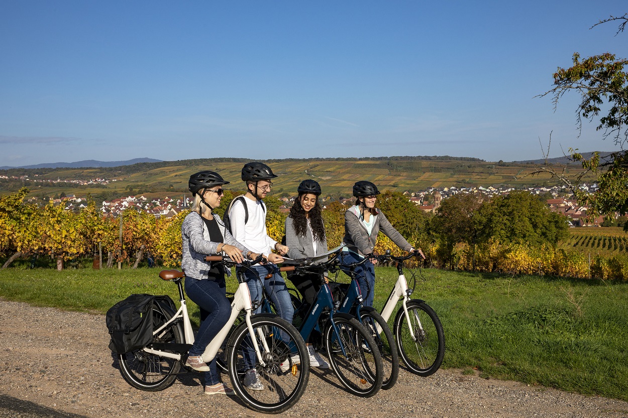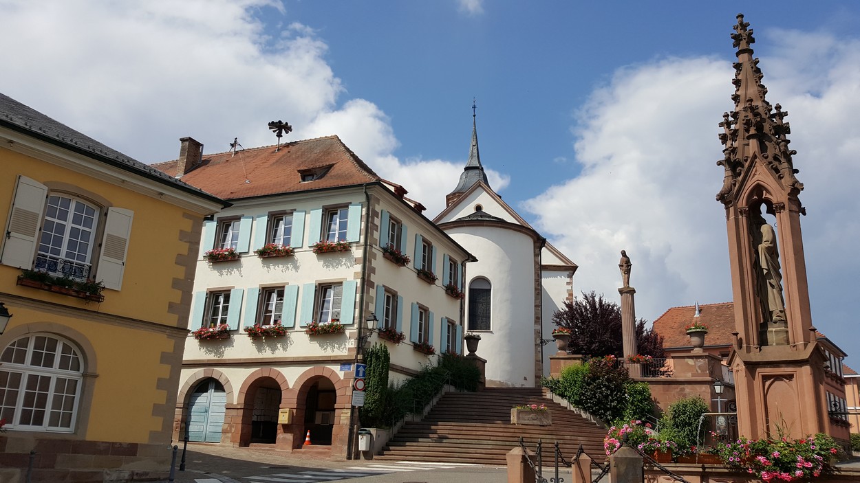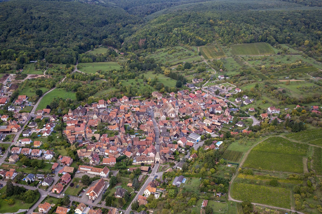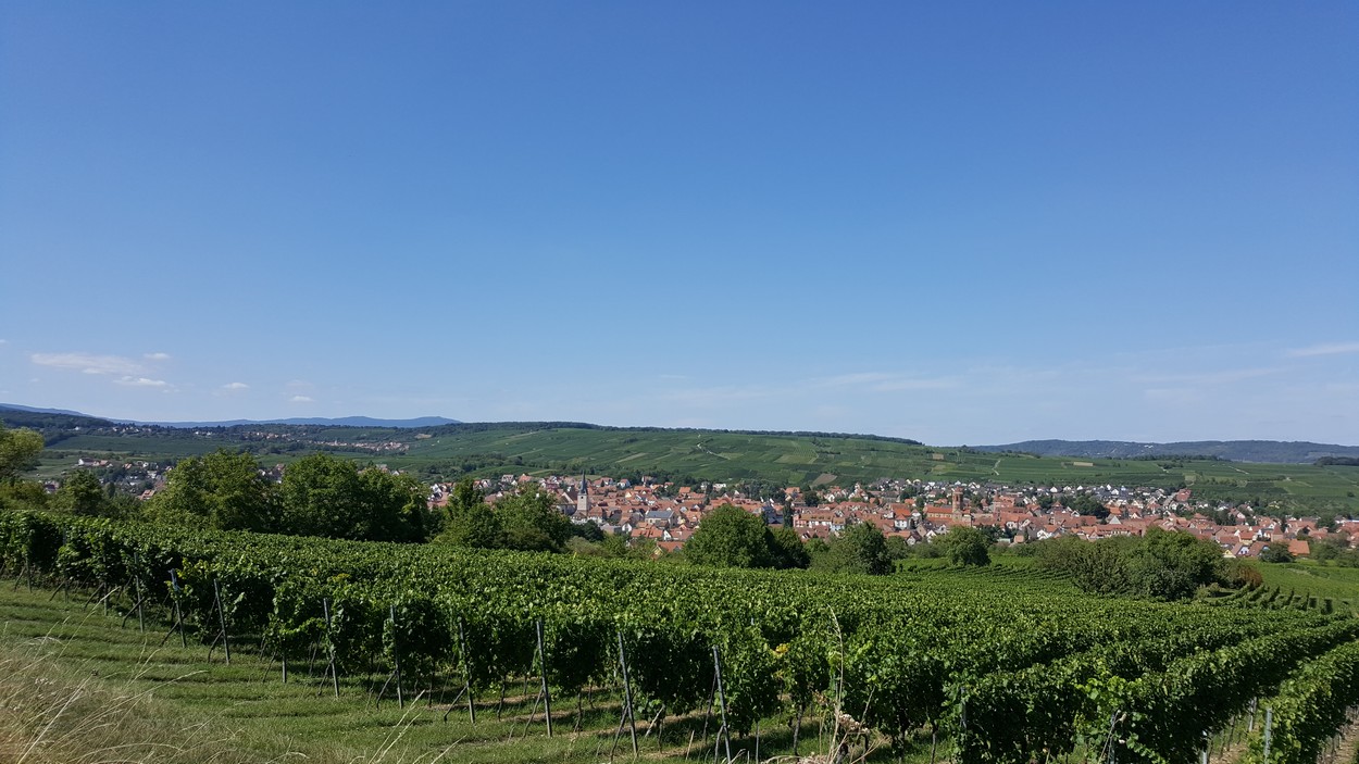
Cycling tour - Around Rosheim
Circuits, sentiers et itinéraires
Parking du Neuland - 67560 Rosheim
03 88 50 75 38 - contact@mso-tourisme.com
www.mso-tourisme.com
The Green Path "Portes Bonheur, chemin des carrières" which extends for 11km from Rosheim to Saint-Nabor, also offers the possibility to leave the path and discover on a circular route, other points of view and landscape perspectives!
The "Eichwald" circuit will take you to the heights of Klingenthal, where you can discover the museum of the Manufacture d'Armes Blanches, a real jewel tracing the history of this preserved and green valley!
- Departure: The Pavilion in Rosheim, on the route of the Green Way "Portes Bonheur, le chemin des carrières".
- Parking possible:Parking du Neuland.
o
Length of visit/event :
1hLevel of difficulty :
EasyDistance (km) to the nearest station :
2location
Calculate itinerary:
Venue of the event :
Neuland Car park in RosheimLevel of difficulty :
EasyLength of visit/event :
1hDifference in altitude (in m) :
104Length of the itinerary :
11,27This might interest you too
GreenWay - "Portes Bonheur, the lane to Saint Nabor quarry "
Rosheim+
Hiking tour - Between vineyards and orchards
Rosheim+
Hiking tour - The Abbeys
Saint Nabor+
Hiking tour - The Ottrott Castles
Ottrott+
Hiking tour - The Bischenberg
Rosheim+
Hiking tour - From Boersch to Obernai
Boersch+
Walking tours - From the gates of Boersch to St-Léonard
Boersch+
Hiking tour - The Westerberg
Rosheim+
Cycling tour - Mont Sainte-Odile
Rosheim+
Cycling tour - the Eichwald
Rosheim+
Cycling tour - around the Voie Verte
Rosheim+
Array
(
[id] => 258003192
[nom] => Cycling tour - Around Rosheim
[type] => Array
(
[id] => 1900316
[nom] => Circuits, sentiers et itinéraires
)
[entite_gestionnaire] => 258
[nom_entite_gestionnaire] => Office de tourisme intercommunal du Mont Sainte-Odile
[coordonnees] => Array
(
[libelle_voie] => Parking du Neuland
[code_postal] => 67560
[libelle_commune] => Rosheim
[telephone1] => 03 88 50 75 38
[email1] => contact@mso-tourisme.com
[url1] => www.mso-tourisme.com
[pays] => FRANCE
)
[insee] => 67411
[type_georeferencement] => 2
[libelle_georeferencement] => précis
[latitude] => 48,4985935210187
[longitude] => 7,47028949209595
[commentaire] => <Strong>The Green Path "Portes Bonheur, chemin des carrières" which extends for 11km from Rosheim to Saint-Nabor, also offers the possibility to leave the path and discover on a circular route, other points of view and landscape perspectives! </Strong>
<br><br>
The "Eichwald" circuit will take you to the heights of Klingenthal, where you can discover the museum of the Manufacture d'Armes Blanches, a real jewel tracing the history of this preserved and green valley! <br><br>
- Departure: The Pavilion in Rosheim, on the route of the Green Way "Portes Bonheur, le chemin des carrières". <br>
- Parking possible:Parking du Neuland.
[prestataire] => Array
(
[raison_sociale] => Office de Tourisme Interco.du Mont Sainte-Odile
[civilite] =>
[nom] => SCHWEBEL
[prenom] => Christelle
[fonction] => Directrice
[coordonnees] => Array
(
[num_voie] => 94
[libelle_voie] => Route du Général de Gaulle
[distri_speciale] =>
[code_postal] => 67560
[libelle_commune] => Rosheim
[telephone1] => 03 88 50 75 38
[telephone2] =>
[telephone3] =>
[fax] =>
[email1] => contact@mso-tourisme.com
[email2] =>
[url1] => www.mso-tourisme.com
[url2] =>
[pays] => FRANCE
)
)
[debut_validite] => 09/03/2020
[fin_validite] => 31/12/2050
[marquage] => 0
[datmaj] => 22/01/2026 16:08:59
[datecreation] => 30/07/2020 11:26:51
[horaires] => Array
(
)
[produits_associes] => Array
(
[0] => Array
(
[id] => 258002951
[nom] => GreenWay - "Portes Bonheur, the lane to Saint Nabor quarry "
[id_type] => 1900316
[type_couplage] => 10
)
[1] => Array
(
[id] => 258003133
[nom] => Hiking tour - Between vineyards and orchards
[id_type] => 1900316
[type_couplage] => 10
)
[2] => Array
(
[id] => 258003152
[nom] => Hiking tour - The Abbeys
[id_type] => 1900316
[type_couplage] => 10
)
[3] => Array
(
[id] => 258003159
[nom] => Hiking tour - The Ottrott Castles
[id_type] => 1900316
[type_couplage] => 10
)
[4] => Array
(
[id] => 258003160
[nom] => Hiking tour - The Bischenberg
[id_type] => 1900316
[type_couplage] => 10
)
[5] => Array
(
[id] => 258003186
[nom] => Hiking tour - From Boersch to Obernai
[id_type] => 1900316
[type_couplage] => 10
)
[6] => Array
(
[id] => 258003187
[nom] => Walking tours - From the gates of Boersch to St-Léonard
[id_type] => 1900316
[type_couplage] => 10
)
[7] => Array
(
[id] => 258003188
[nom] => Hiking tour - The Westerberg
[id_type] => 1900316
[type_couplage] => 10
)
[8] => Array
(
[id] => 258003189
[nom] => Cycling tour - Mont Sainte-Odile
[id_type] => 1900316
[type_couplage] => 10
)
[9] => Array
(
[id] => 258003190
[nom] => Cycling tour - the Eichwald
[id_type] => 1900316
[type_couplage] => 10
)
[10] => Array
(
[id] => 258003193
[nom] => Cycling tour - around the Voie Verte
[id_type] => 1900316
[type_couplage] => 10
)
)
[criteres] => Array
(
[0] => Array
(
[id] => 900000
[nom] => Secteur
[type_critere] => -1
[type_valeur] => 2
[classe] => 0
[modalites] => Array
(
[0] => Array
(
[id] => 1903852
[nom] => Région
[ordre] => 0
)
)
)
[1] => Array
(
[id] => 900002
[nom] => Tracé KML
[type_critere] => 0
[type_valeur] => 6
[classe] => 2
[valeur] => https://apps.tourisme-alsace.info/traces/258003192.kml
)
[2] => Array
(
[id] => 900007
[nom] => Tracé GPX
[type_critere] => 0
[type_valeur] => 6
[classe] => 2
[valeur] => https://apps.tourisme-alsace.info/traces/258003192.gpx
)
[3] => Array
(
[id] => 1900013
[nom] => Distance (km) to the nearest station
[type_critere] => 0
[type_valeur] => 1
[classe] => 2
[valeur] => 2
)
[4] => Array
(
[id] => 1900179
[nom] => Classification Flowered Villages
[type_critere] => 1
[type_valeur] => 2
[classe] => 1
[modalites] => Array
(
[0] => Array
(
[id] => 1900894
[nom] => 3 flowers
[ordre] => 3
)
)
)
[5] => Array
(
[id] => 1900219
[nom] => Venue of the event
[type_critere] => 0
[type_valeur] => 2
[classe] => 2
[valeur] => Neuland Car park in Rosheim
)
[6] => Array
(
[id] => 1900358
[nom] => A transmettre pour Internet
[type_critere] => 1
[type_valeur] => 2
[classe] => 0
[modalites] => Array
(
[0] => Array
(
[id] => 1902207
[nom] => Yes
[ordre] => 1
)
)
)
[7] => Array
(
[id] => 1900421
[nom] => Photo URL
[type_critere] => 0
[type_valeur] => 6
[classe] => 0
[valeur] => https://apps.tourisme-alsace.info/photos/rosheim/photos/258003192_67.jpg
)
[8] => Array
(
[id] => 1900461
[nom] => Secteur carte
[type_critere] => -1
[type_valeur] => 2
[classe] => 0
[modalites] => Array
(
[0] => Array
(
[id] => 1903506
[nom] => Obernai
[ordre] => 0
)
[1] => Array
(
[id] => 1908335
[nom] => Massif des Vosges
[ordre] => 0
)
[2] => Array
(
[id] => 1908571
[nom] => Route des vins (site Alsace)
[ordre] => 0
)
[3] => Array
(
[id] => 1909124
[nom] => Massif Vosges - Vosges centrales
[ordre] => 0
)
[4] => Array
(
[id] => 1909236
[nom] => Oenotourisme - Coeur d'Alsace
[ordre] => 0
)
[5] => Array
(
[id] => 1911639
[nom] => Alsace (site Alsace)
[ordre] => 0
)
[6] => Array
(
[id] => 1909895
[nom] => Vélo Colmar et centre Alsaceet nord
[ordre] => 0
)
)
)
[9] => Array
(
[id] => 1900480
[nom] => Photo caption
[type_critere] => 0
[type_valeur] => 2
[classe] => 0
[valeur] => ©C.HAMM
)
[10] => Array
(
[id] => 1900482
[nom] => Commentaire court EN
[type_critere] => 0
[type_valeur] => 2
[classe] => 4
[valeur] => Get on your bike and discover the surroundings of Rosheim with the Bischenberg hill, the old medieval town of Boersch and finally the Voie Verte!
)
[11] => Array
(
[id] => 1900487
[nom] => Length of visit/event
[type_critere] => 1
[type_valeur] => 2
[classe] => 4
[modalites] => Array
(
[0] => Array
(
[id] => 1903643
[nom] => 1h
[ordre] => 8
)
)
)
[12] => Array
(
[id] => 1900564
[nom] => Level of difficulty
[type_critere] => 1
[type_valeur] => 2
[classe] => 4
[modalites] => Array
(
[0] => Array
(
[id] => 1904402
[nom] => Easy
[ordre] => 1
)
)
)
[13] => Array
(
[id] => 1900603
[nom] => Photo URL2
[type_critere] => 0
[type_valeur] => 6
[classe] => 0
[valeur] => https://apps.tourisme-alsace.info/photos/rosheim/photos/258003192_4.jpg
)
[14] => Array
(
[id] => 1900661
[nom] => Photo légende 2
[type_critere] => 0
[type_valeur] => 2
[classe] => 0
[valeur] => ©OTIMSO
)
[15] => Array
(
[id] => 1900714
[nom] => Interest
[type_critere] => 1
[type_valeur] => 2
[classe] => 0
[modalites] => Array
(
[0] => Array
(
[id] => 1905854
[nom] => Interest on a regional scale (between 8 and 35 km)
[ordre] => 10
)
)
)
[16] => Array
(
[id] => 1900739
[nom] => Brochures 2006
[type_critere] => -1
[type_valeur] => 2
[classe] => 0
[modalites] => Array
(
[0] => Array
(
[id] => 1912202
[nom] => Fiche pour Cirkwi
[ordre] => 0
)
)
)
[17] => Array
(
[id] => 1900751
[nom] => Photo URL3
[type_critere] => 0
[type_valeur] => 6
[classe] => 0
[valeur] => https://apps.tourisme-alsace.info/photos/rosheim/photos/258003192_5.jpg
)
[18] => Array
(
[id] => 1900752
[nom] => Photo légende 3
[type_critere] => 0
[type_valeur] => 2
[classe] => 0
[valeur] => ©C.Hamm
)
[19] => Array
(
[id] => 1900781
[nom] => Photo URL4
[type_critere] => 0
[type_valeur] => 6
[classe] => 0
[valeur] => https://apps.tourisme-alsace.info/photos/rosheim/photos/258003192_6.jpg
)
[20] => Array
(
[id] => 1900783
[nom] => Photo légende 4
[type_critere] => 0
[type_valeur] => 2
[classe] => 0
[valeur] => ©OTIMSO
)
[21] => Array
(
[id] => 1900916
[nom] => Length of the itinerary
[type_critere] => 0
[type_valeur] => 1
[classe] => 4
[valeur] => 11,27
)
[22] => Array
(
[id] => 1900917
[nom] => Difference in altitude (in m)
[type_critere] => 0
[type_valeur] => 1
[classe] => 2
[valeur] => 104
)
[23] => Array
(
[id] => 1901313
[nom] => Address - location information of car park closest to departure point
[type_critere] => 0
[type_valeur] => 2
[classe] => 1
[valeur] => Neuland Car park in Rosheim
)
[24] => Array
(
[id] => 1901314
[nom] => Commentaire traduit en
[type_critere] => -1
[type_valeur] => 2
[classe] => 0
[modalites] => Array
(
[0] => Array
(
[id] => 1909728
[nom] => DE
[ordre] => 0
)
[1] => Array
(
[id] => 1909729
[nom] => EN
[ordre] => 0
)
[2] => Array
(
[id] => 1909727
[nom] => FR
[ordre] => 0
)
)
)
[25] => Array
(
[id] => 1901319
[nom] => Type of hiking path
[type_critere] => -1
[type_valeur] => 2
[classe] => 32
[modalites] => Array
(
[0] => Array
(
[id] => 1911546
[nom] => bike path / bike lane
[ordre] => 0
)
[1] => Array
(
[id] => 1909740
[nom] => paved road
[ordre] => 0
)
)
)
[26] => Array
(
[id] => 1901401
[nom] => Photo url 16
[type_critere] => 0
[type_valeur] => 6
[classe] => 0
[valeur] => https://apps.tourisme-alsace.info/photos/rosheim/photos/258003192_25.jpg
)
[27] => Array
(
[id] => 1901402
[nom] => Photo légende 16
[type_critere] => 0
[type_valeur] => 2
[classe] => 0
[valeur] => ©S.Spach
)
[28] => Array
(
[id] => 1901413
[nom] => Tarif synthétique (avizi)
[type_critere] => 0
[type_valeur] => 1
[classe] => 32
[valeur] => -1
)
[29] => Array
(
[id] => 1901421
[nom] => GRC pré sélection
[type_critere] => 1
[type_valeur] => 2
[classe] => 0
[modalites] => Array
(
[0] => Array
(
[id] => 1911149
[nom] => Oui
[ordre] => 0
)
)
)
[30] => Array
(
[id] => 1901440
[nom] => GRC accroche
[type_critere] => 0
[type_valeur] => 2
[classe] => 4
[valeur] => Get on your bike and discover the surroundings of Rosheim with the Bischenberg hill, the old medieval town of Boersch and finally the Voie Verte!
)
[31] => Array
(
[id] => 1901464
[nom] => Légende photo 2
[type_critere] => 0
[type_valeur] => 2
[classe] => 0
[valeur] => La place Saint-Rémi de Bischoffsheim
)
[32] => Array
(
[id] => 1901465
[nom] => Légende photo 3
[type_critere] => 0
[type_valeur] => 2
[classe] => 0
[valeur] => Boersch vu du ciel
)
[33] => Array
(
[id] => 1901466
[nom] => Légende photo 4
[type_critere] => 0
[type_valeur] => 2
[classe] => 0
[valeur] => Vue sur Rosheim
)
[34] => Array
(
[id] => 1901495
[nom] => Liesel - inspiration
[type_critere] => 1
[type_valeur] => 2
[classe] => 0
[modalites] => Array
(
[0] => Array
(
[id] => 1911411
[nom] => Bouger, se défouler
[ordre] => 50
)
)
)
[35] => Array
(
[id] => 1901499
[nom] => La photo est disponible en OpenData (Datatourisme)
[type_critere] => 1
[type_valeur] => 2
[classe] => 0
[modalites] => Array
(
[0] => Array
(
[id] => 1911420
[nom] => Oui
[ordre] => 10
)
)
)
[36] => Array
(
[id] => 1901505
[nom] => Type de circuit, itinéraire
[type_critere] => 1
[type_valeur] => 2
[classe] => 4
[modalites] => Array
(
[0] => Array
(
[id] => 1911538
[nom] => Cycling (road, cycle path)
[ordre] => 20
)
)
)
[37] => Array
(
[id] => 1901509
[nom] => URL site Liesel
[type_critere] => 0
[type_valeur] => 6
[classe] => 0
[valeur] => https://en.liesel.alsace/article/circuit-autour-de-rosheim-258003192
)
[38] => Array
(
[id] => 1901517
[nom] => Url photo Opendata
[type_critere] => 0
[type_valeur] => 6
[classe] => 0
[valeur] => https://opendata.tourisme-alsace.info/photos/rosheim/photos/258003192_67_800x600.jpg
)
[39] => Array
(
[id] => 1901519
[nom] => Cpyright photo Opendata
[type_critere] => 0
[type_valeur] => 2
[classe] => 0
[valeur] => ©C.HAMM
)
[40] => Array
(
[id] => 1901523
[nom] => Nom de la gare la plus proche
[type_critere] => 0
[type_valeur] => 2
[classe] => 2
[valeur] => Rosheim
)
[41] => Array
(
[id] => 258000003
[nom] => Odile site Internet
[type_critere] => 1
[type_valeur] => 2
[classe] => 32
[modalites] => Array
(
[0] => Array
(
[id] => 258000005
[nom] => yes
[ordre] =>
)
)
)
[42] => Array
(
[id] => 258000021
[nom] => OTI : participez
[type_critere] => -1
[type_valeur] => 2
[classe] => 32
[modalites] => Array
(
[0] => Array
(
[id] => 258000088
[nom] => à Vélo
[ordre] => 10
)
)
)
[43] => Array
(
[id] => 258000064
[nom] => PBonheur - Carto
[type_critere] => 1
[type_valeur] => 2
[classe] => 32
[modalites] => Array
(
[0] => Array
(
[id] => 258000471
[nom] => oui
[ordre] =>
)
)
)
[44] => Array
(
[id] => 258000556
[nom] => Openrunner
[type_critere] => 0
[type_valeur] => 6
[classe] => 32
[valeur] => www.openrunner.com/r/11055705
)
[45] => Array
(
[id] => 258000558
[nom] => Pour tri par commune
[type_critere] => 1
[type_valeur] => 2
[classe] => 32
[modalites] => Array
(
[0] => Array
(
[id] => 258000485
[nom] => Rosheim
[ordre] => 80
)
)
)
)
[disponibilites_synthetiques] => Array
(
)
[disponibilites_detail] => Array
(
)
)


